Whats New
[blog_list thumb=”large” showposts=”2″ post_content=”full” category_in=”blog” pagination=”true” ]

[blog_list thumb=”large” showposts=”2″ post_content=”full” category_in=”blog” pagination=”true” ]
Anyone interested in seeing how the group operates is more than welcome to come out and join us at the different dive sites we are currently exploring. If you’d like more info about a particular date or site feel free to contact the project manager by clicking on the location as they are added below. Be aware that some sites are remote and that packing in food and water is a must.
The Ozark Cave Diving Alliance is currently looking for qualified divers with a willingness to work in a team environment focusing on underwater cave and spring research.
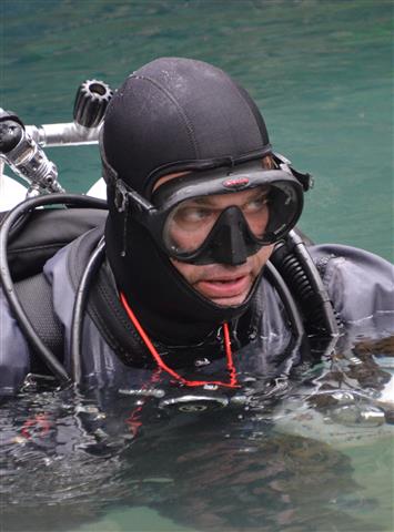
Currently, the team is working shallow side mount systems with difficult access along with deep, significant deco sites in the Missouri, Arkansas, and Oklahoma areas. Conditions are typically cold and otherwise vary from good to grim, so zero visibility experience/comfort are a must for advanced divers within the organization. Nearly all project sites are under research permit with various government agencies, many of which took years to acquire. Modern research includes cave system mapping, photography, video, cave life documentation and tracking, geologic samples, and public awareness presentations. A lot of work goes on behind the scenes and it isn’t all easy. All members are non-smokers who maintain a good level of fitness commensurate with their level of diving and generally bust ass to stay proficient in the different types of environments presented (dry caving included). Equipment should be of the DIR configuration and Cave Diver certification along with DAN Master insurance are required. If you’re married a very understanding spouse is also a plus. Most active members are diving several times a month and driving considerable distances to the active sites. Diving a couple times a year will not keep you proficient for the type of diving required here, so please consider your level of commitment before considering this kind of activity. Days can be very long and participants are required to pay their own way. Following a sponsorship and being voted in, new capable divers start at a support level and can work their way up quickly while enjoying an opportunity to provide useful information on cave systems around the Midwest. New members must be sponsored by an active member of the team.
If you are interested in seeing what the Ozark Cave Diving Alliance has to offer, feel free to join us at project sites where you can introduce yourself, help out, and see what we do on a first hand basis. For project dates and locations, see the news section, our Facebook page, or contact one of the members listed here for more information. Thank you for your interest in the OCDA.
Dirk Bennett
Director, OCDA
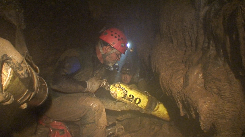
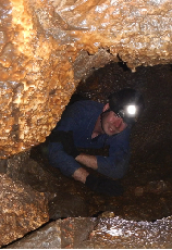
A section of dry cave passage that is filled with water is called a sump. Therefore sump diving is a mixture of dry caving and cave diving. These are often times some of the more physically demanding projects as team members are required to haul heavy gear through multiple dry passages. Also, these sumps are typically very low in visibility due to silt disturbance.
To the right are a few locations that some of the team members have worked on in conjunction with various grottos and other organizations. While not everyone is into sump diving and the usual gear humping that comes with it, it can sure be a rewarding experience. Some of the OCDA team members have an NSS background with dry caving and vertical experience.
THE SCIENCE OF THE MISSOURI KARST
by RANDALL C. ORNDORFF
Geological science can benefit greatly from cave diving. Speleogenesis (the development of cave passages) is poorly understood since much cave development occurs below the water table in the saturated subsurface. Cave surveys, videography, and rock samples collected by cave divers gives scientists a better chance to understand how cave systems and large spring systems form.
The Ozarks of southeastern Missouri contains a world-class spring system with the highest concentration of large springs in the United States. Protecting this natural resource is important for water quality, tourism in National and State parks, and an appreciation on how these large springs form.
Geologists from the U.S. Geological Survey are working with the Ozark Cave Diving Alliance (OCDA) to collect information from the springs to better understand the geologic controls on how Ozark caves form. The geologists had an idea on how the rock strata played a part in the formation of the cave, but they needed an accurate cave survey and rock samples from various areas to prove this idea. The great majority of the rock strata in this area are dolomite (a cousin of limestone) that dissolves to form the caves that dominate the region. Active solution of the rock occurs below the water table and when these caves intersect the surface, large springs form. However, there are a few beds of sandstone that are a part of the stratigraphic package. The idea is that ground water trapped beneath these sandstone horizons is under pressure and enhances the dissolution beneath the sandstone. Once the cave system gets large enough, it breaks through the sandstone and rapidly dissolves the dolomite above as the water works its way to the surface to form the spring.
Alley Spring, within the Ozark National Scenic Riverways (National Park Service), is an ideal place to test the idea. The OCDA found that the deepest part of the cave system, to date, is about 160 ft deep and levels out beneath a sandstone horizon. The cave survey verified depth and rock samples verified sandstone rock type. Information from the cave survey and the videography of Alley Spring show the cave system breaking through the sandstone bed in several areas. Future work by the OCDA in Alley Spring, and other Ozark spring systems, will help define the morphology of the cave system and help the scientists to understand Ozark springs and environmental affects on ground water.
Randall Orndorff, USGS
Here you will find links to our videos posted elsewhere on the site. Most are 720p and are responsive so may be viewed at 480p or 360p according to what you are using, ie mobile devices. We are in the process of updating our videos so bear with us.
The Lewis Cave trip page is here.
The Carroll Cave Lake Room trip page is here.
The New Mertz Cave trip page is here.

Name: Kevin Runkle
Residence: Kansas
Diving Since: 2000
Number of Dives: 500+
Team Specialty: Team Director: Exploration; Survey; Sump Diver
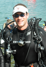
Name: Bob Koch
Residence: Oklahoma
Diving Since: 1970
Number of Dives: 462
Team Specialty: Team Director; Exploration; Video; Sump Diver
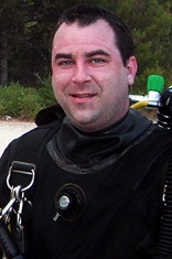
Name: Chris Hill
Residence: Missouri
Diving Since: 1978
Number of Dives: 800+
Team Specialty: Public Relations
Name: Joseph McCord
Residence: Missouri
Diving Since: 1998
Number of Dives: 1000+
Team Specialty: Equipment Manager; Exploration; Survey
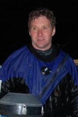
Name: Dirk Bennett
Residence: Kansas
Diving Since: 2000
Number of Dives: 694
Team Specialty: Exploration; Survey
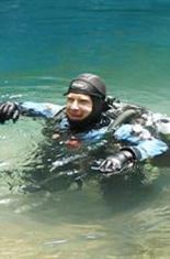
Name: Konstantin Chartkov
Residence: Missouri
Diving Since: 2010
Number of Dives: 300+
Team Specialty: Team Secretary: Mid-range and Support
Name: Dave Frawley
Residence: Missouri
Diving Since: 1995
Number of Dives: 400+
Team Specialty: Safety Officer: Mid-range: Support
Name: Eric Sommer
Residence:Kansas
Diving Since: 2010
Number of Dives: 150
Team Specialty: Support

Name: Jennifer Idol
Residence: Texas
Diving Since: 1995
Number of Dives: 1000+
Team Specialty: Underwater Photography: Support
Website: www.uwDesigner.com
Name: Nik Kuzmanovic
Residence: Oklahoma
Diving Since: 2002
Number of Dives: 800+
Team Specialty: Sidemount; Sump Diving; Survey
Name: Donovan Rayon
Residence: Oklahoma
Diving Since: 2009
Number of Dives: 500+
Team Specialty: Support

Name: Brian Hayden
Residence: Missouri
Diving Since: 2005
Number of Dives: 700
Team Specialty: Mid-Range
Name: Christa Henderson
Residence:Kansas
Diving Since: 2008
Number of Dives: 500+
Team Specialty: Support:
Name: Tucker Palmatier
Residence: Ohio
Diving Since: 2012
Number of Dives: 150+
Team Specialty: Support
Name: Jason Wright
Residence: Texas
Diving Since:
Number of Dives:
Team Specialty: Support
Name: Rob LaForce
Residence: Missouri
Diving Since:
Number of Dives:
Team Specialty: Support
Name: Jeremiah Lehman
Residence: Kansas
Diving Since:
Number of Dives:
Team Specialty: Support
Name:
Residence:
Diving Since:
Number of Dives:
Team Specialty:
Name:
Residence:
Diving Since:
Number of Dives:
Team Specialty:
Name:
Residence:
Diving Since:
Number of Dives:
Team Specialty:
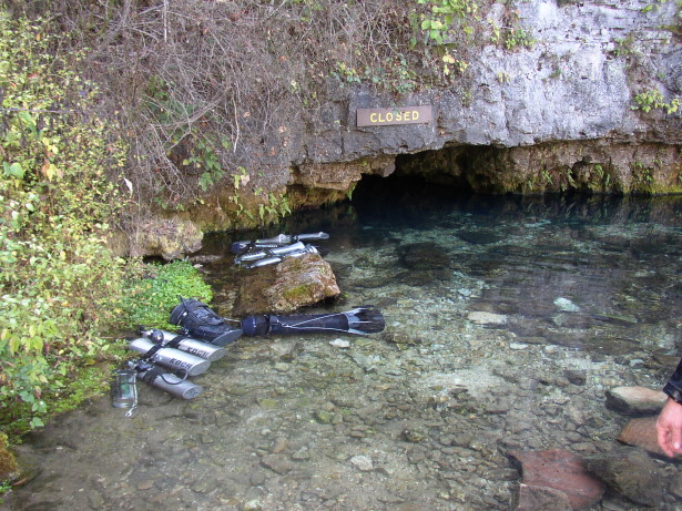 LOCATION: Along the Current River in Shannon County, MO.
SIZE: Ranked the 6th largest spring in the state with an average discharge of 105 million gallons of groundwater per day.
OWNERS: Owned by the National Park Service since 1967. However, this spring is closed to the public due to white nose syndrome in bats and for safety reasons.
DIVING HISTORY: This area was settled in 1855 by Thomas Welch whose family ran a gristmill for fifty years after the Civil War. The spring and 40 acres were sold in 1913 to Dr. Chrisian Diehl of Roxana, Ill., who spent the next 30 years alternately practicing medicine in IL in the winter, and building/promoting a sanitarium for asthma sufferers in the spring. It was common for people to mistake the cave air for having medicinal purposes. The ruins of the hospital are still standing against the bluff but are closed to the public.
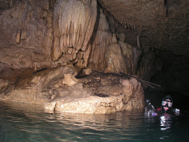
The OCDA was given the opportunity to explore Welch Spring in 2007. Inside the gated entrance is an underground lake 10-18 ft deep, and there is living cave on the ceiling. There is dry passage which extends into the bluff from this lake area which has been mapped in the past. There is a rather large beaver living back in here which is responsible for the wood branches in the picture below. The spring then descends to 149 ft and gently ascends to the 100 ft area at the current end of the line. The rather poor visibility in this system is typical of Missouri springs and varies with weather. Exploration of this system will hopefully continue in the future.
 NOTES: Although the average discharge for Welch Spring is higher than Maramec, this average is based on a much smaller sampling size and is therefore lower in rank according to the MDNR. The spring discharge causes the Current River to double in size at this location.


